Overview
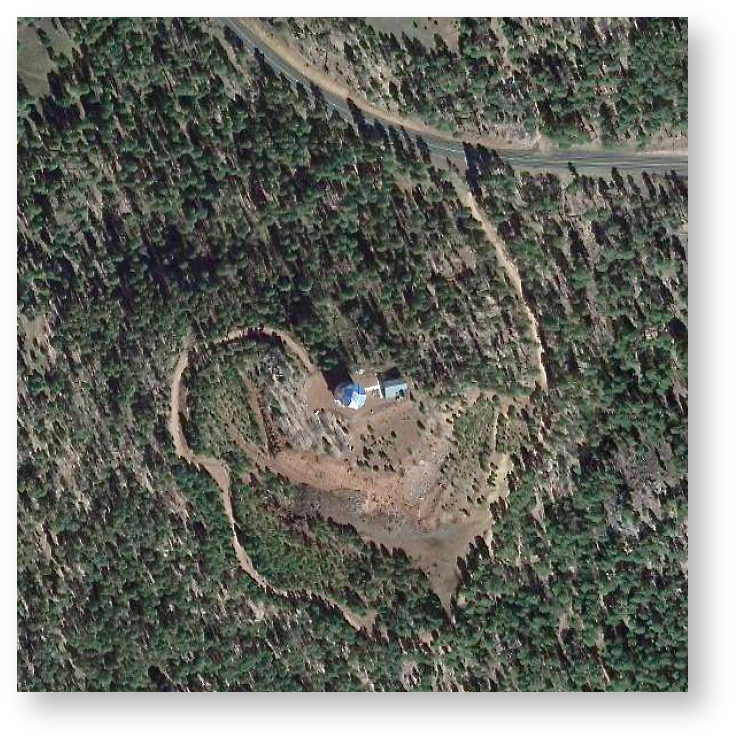
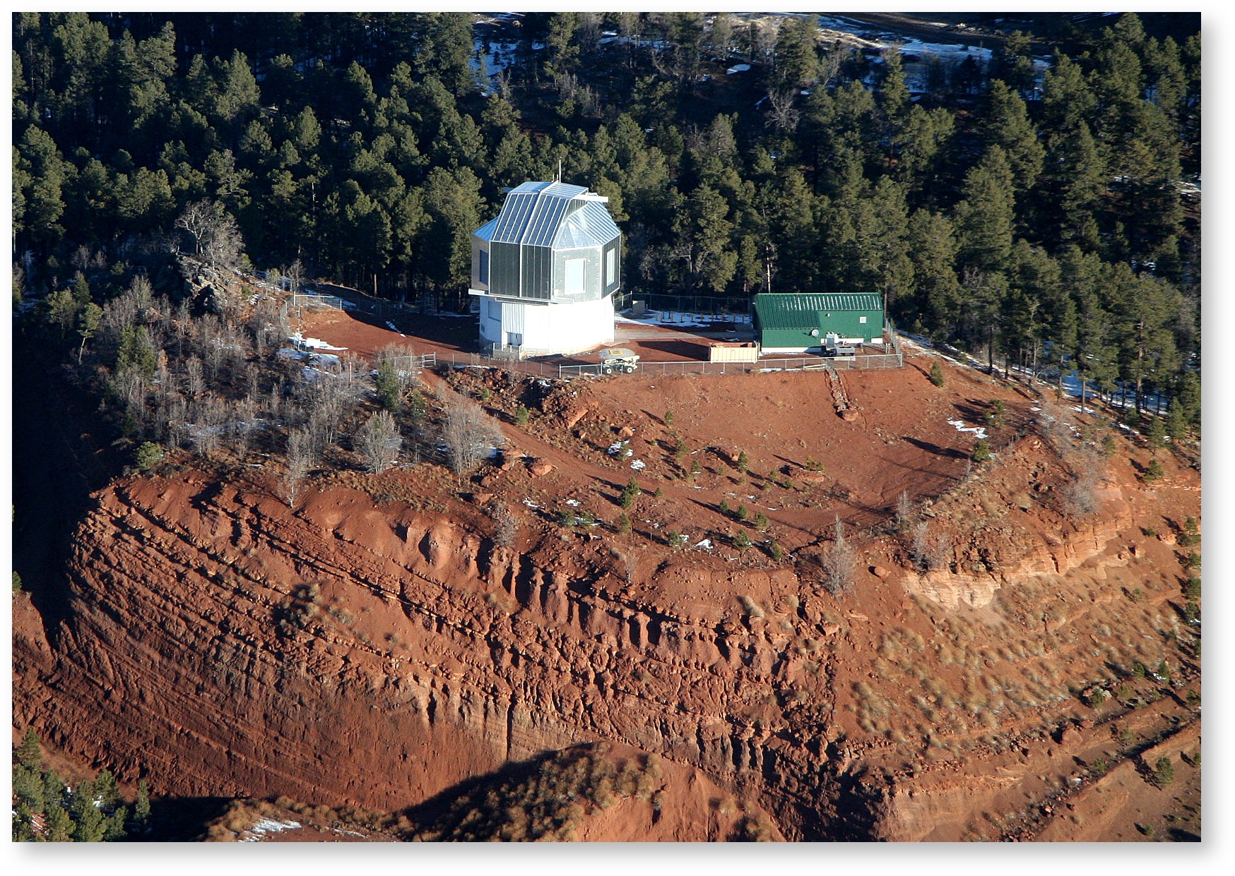
The Lowell Discovery Telescope is near the village of Happy Jack, about 1 hour south of Flagstaff. This dark-sky site sits on the Coconino National forest at an altitude of 7,740 feet. The LDT
Driving to LDT – Directions for how to get to the site
Lodging for LDT Observing Runs – Where to stay during your observing run
More Description
Here
About the Site
Maybe why this place was chosen
Link to Site Survey Paper?
Altitude / Humidity / On-Site safety:
Lodging for LDT Observing Runs – Where to stay during your observing run- Because of the altitude and low humidity of the LDT site, remember to drink plenty of water to avoid dehydration.
Driving to LDT – Directions for how to get to the site
- If you have not been to the site before, please don't enter without a Lowell staffer, or someone who is familiar with the site. There is an alarm that needs to be dis-armed, and it is not always obvious how. Your lodging packet should include keys and written instructions about the gate and alarm codes.
Site Coordinates:
Measured Coordinates | Encoded Coordinates |
|---|---|
From the site GPS unit: (Symmetricom S250, WGS84) Date: 2013-07-08 UT Latitude: 34:44:39.498 N Longitude: 111:25:21.054 W Altitude: 2337 meters | Coded into the TCS: Date: 2013-07-08 UT Latitude: 34.7443 = 34:44:39.48 N Longitude: 111.4223 = 111:25:20.28 W Altitude: 2361 meters |
From the POETS Green GPS: (Spectrum TSTM-4, WGS84) Date: 2013-01-10 UT Latitude: 34:44:39.60 N Longitude: 111:25:20.40 W Altitude: 2388 meters (on the El ring) Date: 2013-03-05 UT Latitude: 34:44:39.60 N Longitude: 111:25:21.60 W Altitude: 2344 meters (on the El ring) | Coded into the MCU: Date: 2013-07-08 UT Latitude: 34.7443 = 34:44:39.48 N Longitude: 248.5774E = 360 - 248.5774 W = 111.4226 W = 111:25:21.36 W Altitude: 2336 meters |
Note: There is a slight degeneracy between longitude latitude and elevation in GPS measurements, hence different values may appear slightly different.coordinates vary slightly.
| CSS Stylesheet |
|---|
.dropdown{
background: #ff52cc;
color: #c2d6d6;
font-size: 20px;
padding: 20px;
} |