| Float | ||
|---|---|---|
| ||
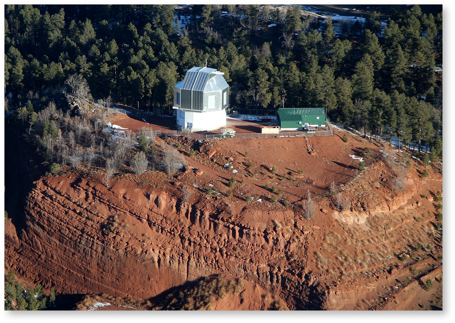
Overview
The Lowell Discovery Telescope is near the village of Happy Jack, about 1 hour south of Flagstaff. This dark-sky site sits on the Coconino National forest at an altitude of 7,740 feet. The LDT enclosure and D. Blackett & R. Wachs Telescope Support Building sit atop an extinct cinder cone located on a 35-acre special use permit area of USFS land.
Site Characteristics:
- Good seeing
- Dark site
- Previously disturbed site as the cinder cone was mined for cinders. This is why the southern side below the observatory is so steep. The land is owned by the USFS and because it was already disturbed, this simplified the required environmental impact assessment.
- Proximity to road and power, and modest travel time to Flagstaff.
Site Survey Paper: Bida, T. A., et al. 2004, Proc. SPIE, 5489, 196
Driving to LDT – Directions for how to get to the site
Lodging for LDT Observing Runs – Where to stay during your observing run
On-Site safety:
- Because of the altitude and low humidity of the LDT site, remember to drink plenty of water to avoid dehydration.
- If you have not been to the site before, please don't enter without a Lowell staffer, or someone who is familiar with the site. There is an alarm that needs to be dis-armed, and it is not always obvious how. Your lodging packet should include keys and written instructions about the gate and alarm codes.
Driving to LDT – Directions for how to get to the site
Lodging for LDT Observing Runs – Where to stay during your observing runSite Coordinates:
Measured Coordinates | Encoded Coordinates |
|---|---|
From the site GPS unit: (Symmetricom S250, WGS84) Date: 2013-07-08 UT Latitude: 34:44:39.498 N Longitude: 111:25:21.054 W Altitude: 2337 meters | Coded into the TCS: Date: 2013-07-08 UT Latitude: 34.7443 = 34:44:39.48 N Longitude: 111.4223 = 111:25:20.28 W Altitude: 2361 meters |
From the POETS Green GPS: (Spectrum TM-4, WGS84) Date: 2013-01-10 UT Latitude: 34:44:39.60 N Longitude: 111:25:20.40 W Altitude: 2388 meters (on the El ring) Date: 2013-03-05 UT Latitude: 34:44:39.60 N Longitude: 111:25:21.60 W Altitude: 2344 meters (on the El ring) | Coded into the MCU: Date: 2013-07-08 UT Latitude: 34.7443 = 34:44:39.48 N Longitude: 248.5774E = 360 - 248.5774 W = 111.4226 W = 111:25:21.36 W Altitude: 2336 meters |
Note: There is a slight degeneracy between latitude and elevation in GPS measurements, hence coordinates vary slightly.
| CSS Stylesheet |
|---|
.dropdown{
background: #ff52cc;
color: #c2d6d6;
font-size: 20px;
padding: 20px;
} |